
Understanding water in the Sahara.
Before digging, we study. Why is there water beneath one of the world's most arid deserts? Where does it come from, and why is some water salty? Three explainers on the hydrogeology that makes our wells possible.
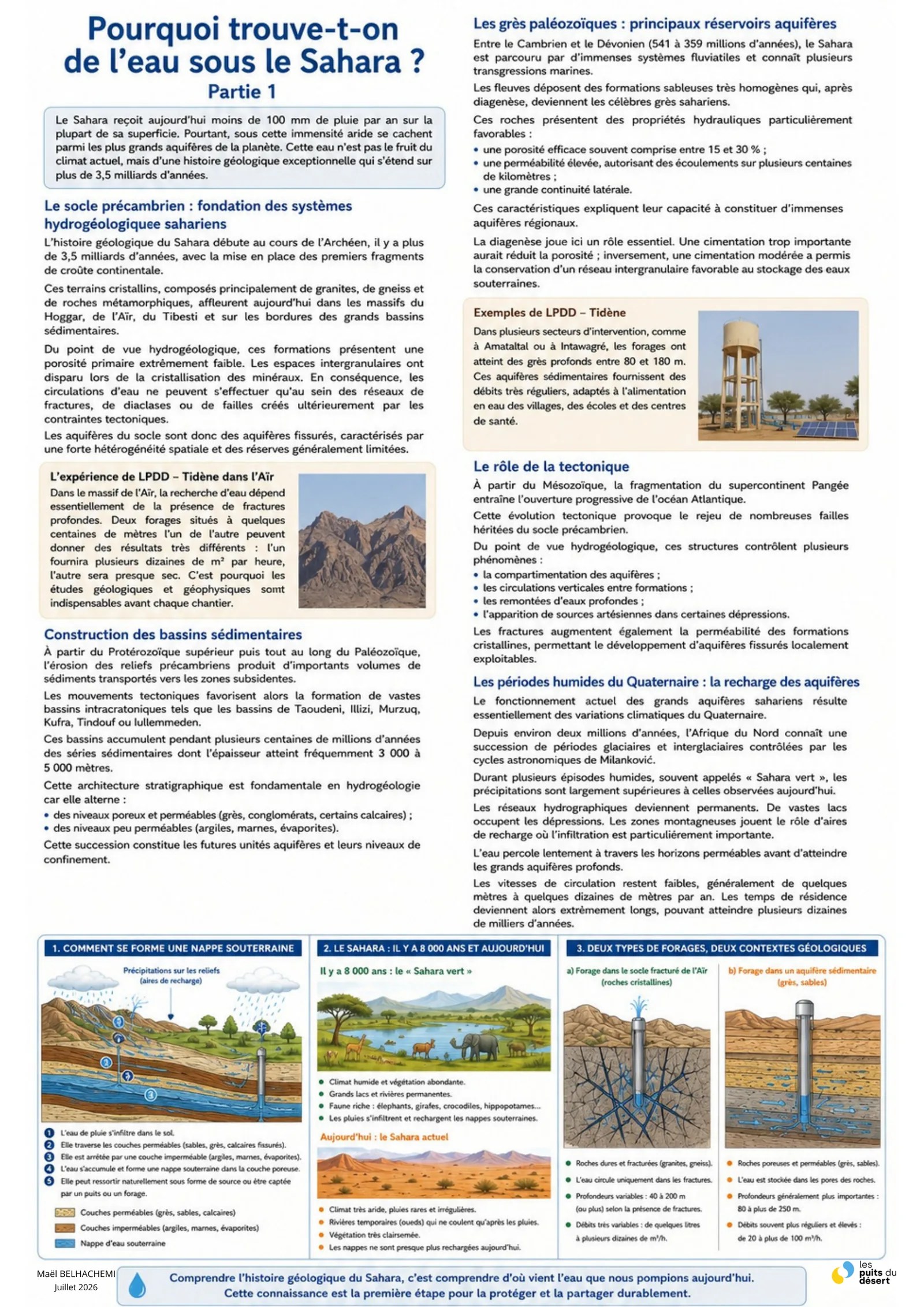
Why is there water beneath the Sahara?
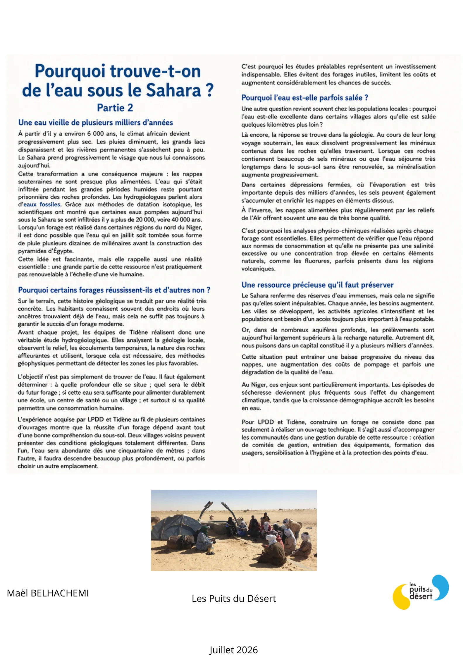
The Sahara receives less than 100 mm of rain per year today, yet conceals one of the planet's largest aquifers — the result of over 3.5 billion years of geological history. Palaeozoic sandstones form vast regional reservoirs, and much of this water is "fossil": it infiltrated tens of thousands of years ago, during the humid periods of the "green Sahara". This is why the teams of Les Puits du Désert and NGO Tidène carry out a full hydrogeological study before every borehole — to determine depth, flow rate and water quality.
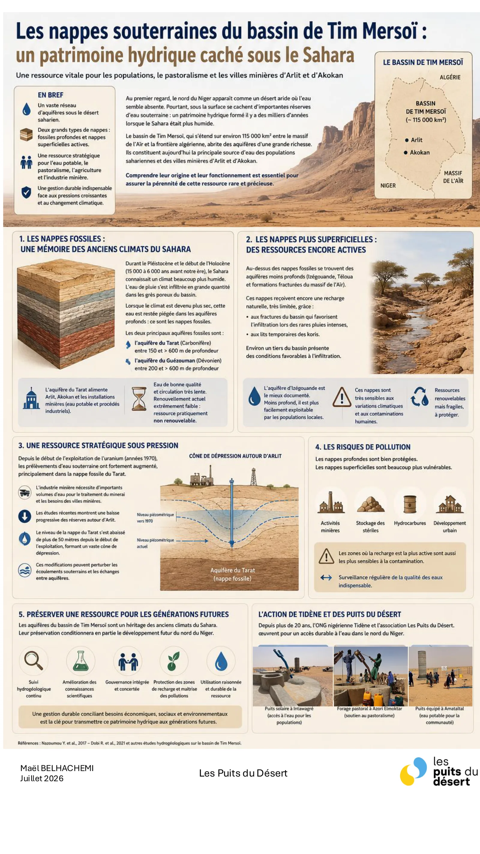
The aquifers of the Tim Mersoï basin
The Tim Mersoï basin, covering roughly 115,000 km² between the Aïr massif and the Algerian border, holds remarkably rich aquifers. It combines deep fossil aquifers (the Tarat and Guézouman aquifers), a memory of the Sahara's ancient humid climates, and shallower aquifers still recharged by rare rains. It is the main water source for Saharan populations and the mining towns of Arlit and Akokan. A strategic but pressured resource (the cone of depression around Arlit) and vulnerable to pollution, it requires sustainable management — one of the challenges addressed by NGO Tidène and Les Puits du Désert.
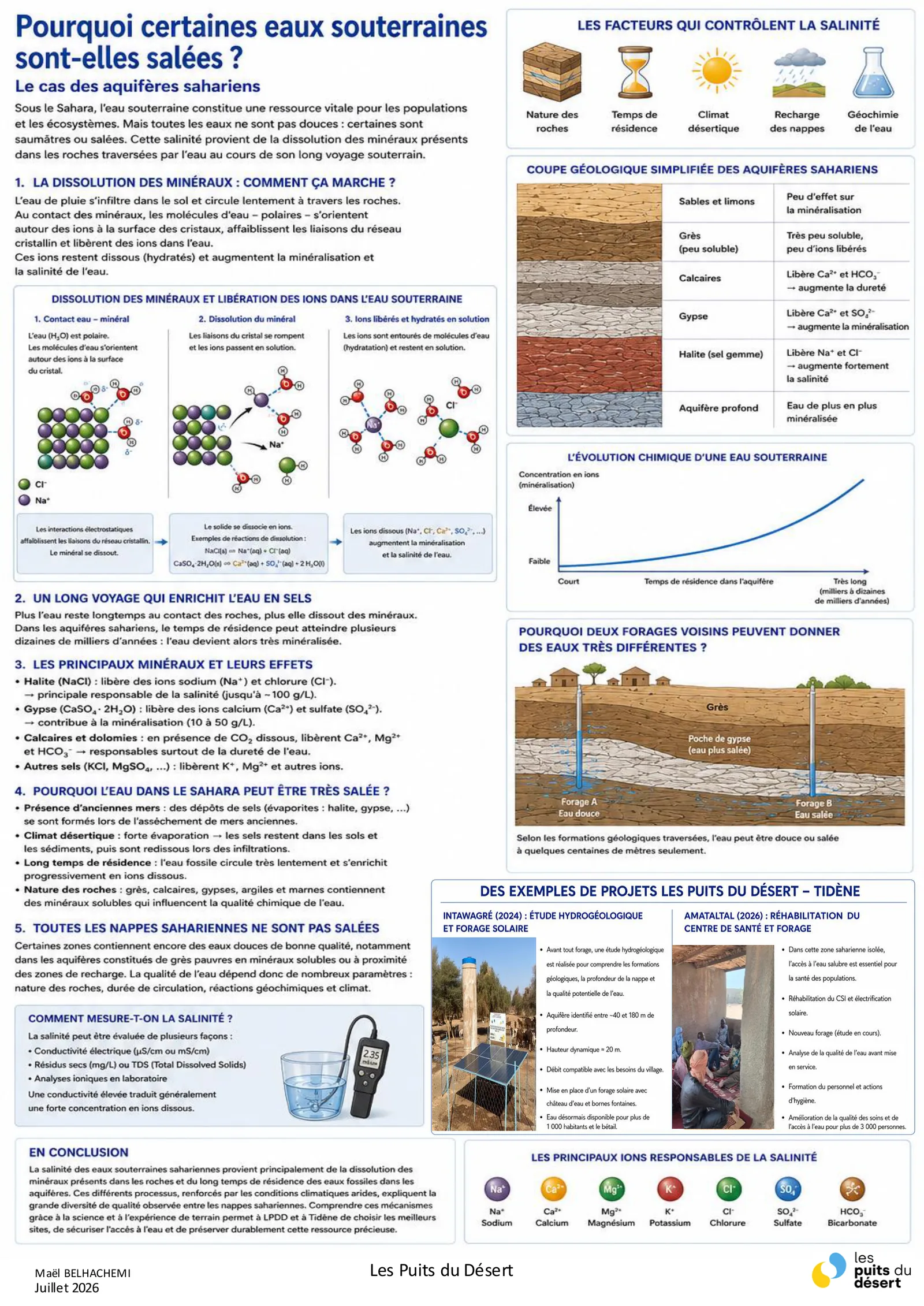
Why is some groundwater salty?
Beneath the Sahara, some groundwater is fresh while other water is brackish or salty. This salinity comes from the dissolution of minerals (halite, gypsum, limestone…) that the water crosses during its long underground journey: the longer it stays, the more mineralised it becomes. This is why two neighbouring boreholes can yield very different water. To guarantee drinking water, Les Puits du Désert and NGO Tidène carry out physico-chemical analyses after every borehole, to check that the water meets consumption standards.
Rainfall in the Aïr massif
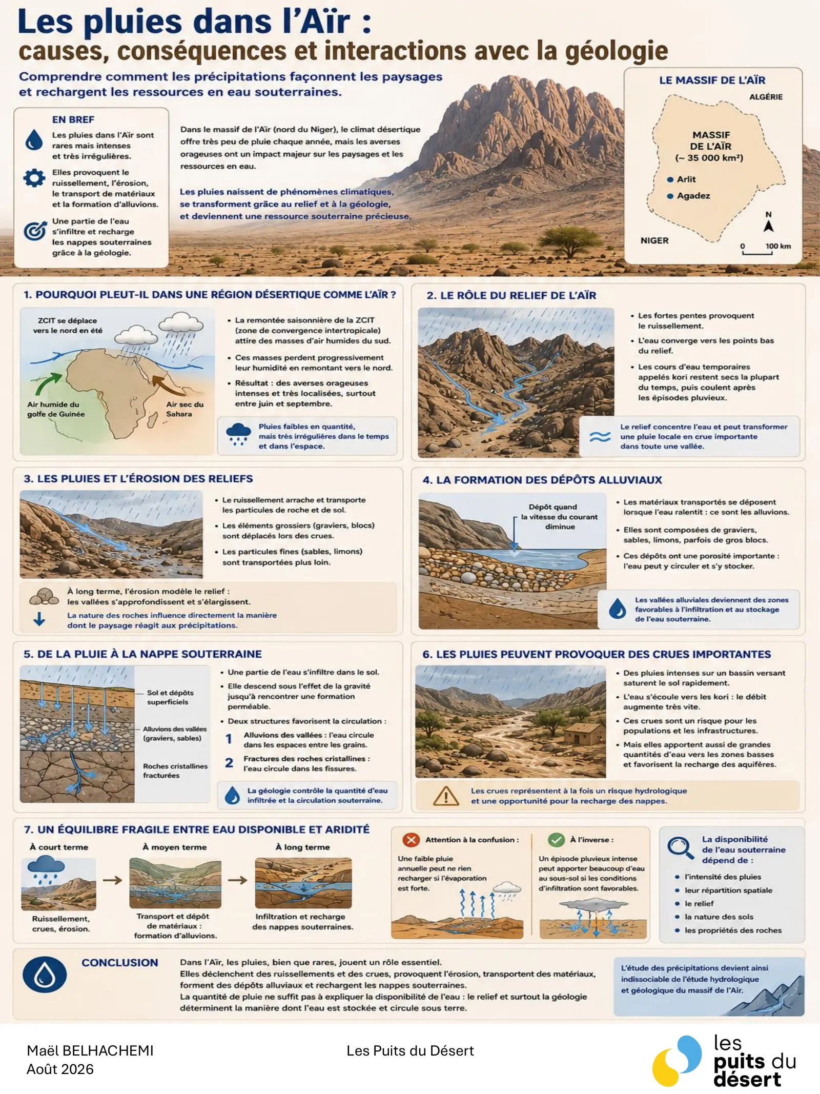
In the Aïr massif, rain is scarce but intense. The seasonal northward shift of the ITCZ draws humid air masses from the Gulf of Guinea, drying as they travel: the result is intense, highly localised thunderstorms, mostly between June and September. Relief then concentrates this rain into floods along the kori, temporary watercourses that stay dry most of the year. Runoff erodes, carries and deposits alluvium whose porosity lets water infiltrate and recharge the aquifers. Rainfall alone therefore does not explain water availability: relief and geology determine how water is stored and how it flows underground.
The main rocks of the Aïr massif
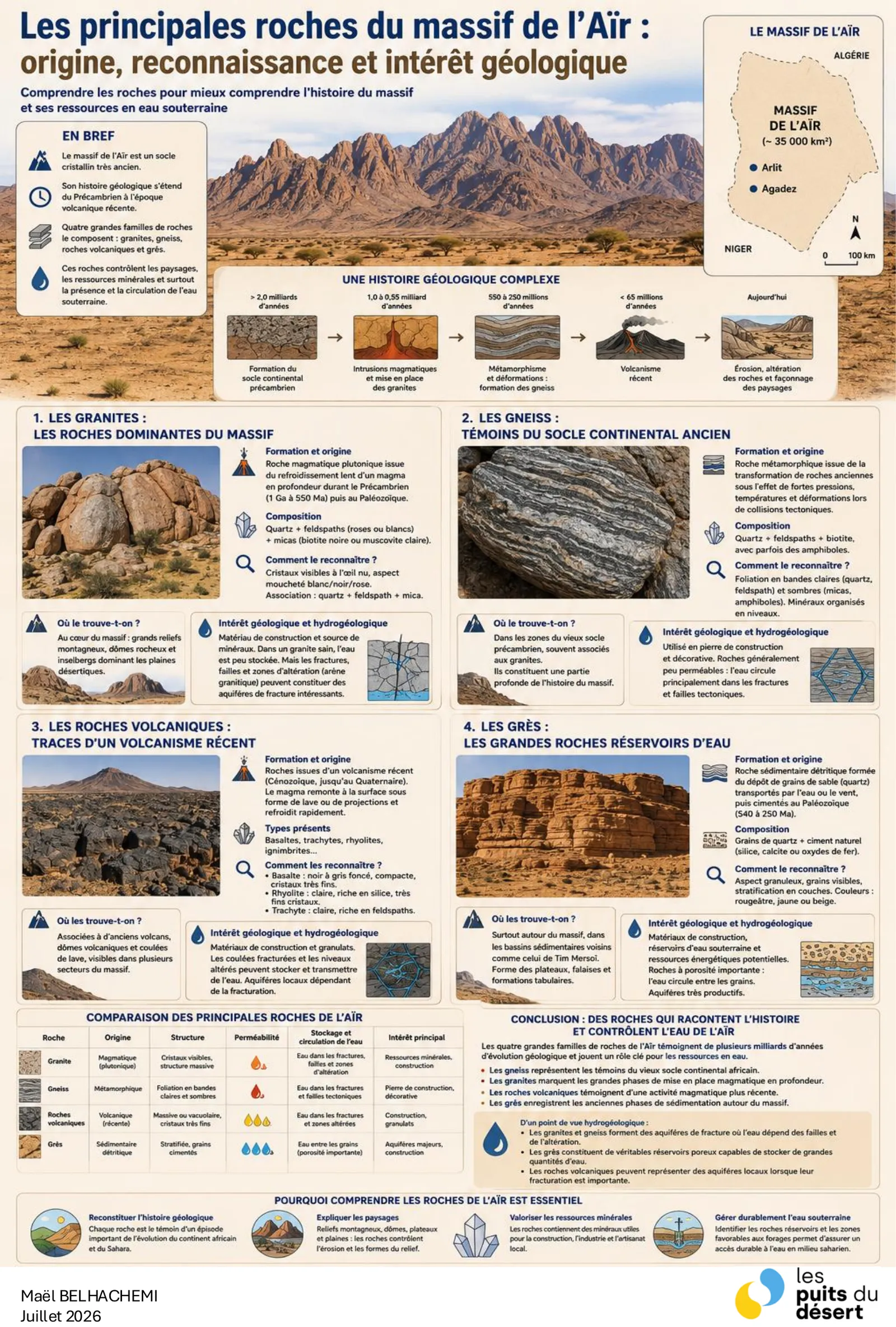
The Aïr massif rests on a very ancient crystalline basement whose history runs from the Precambrian to recent volcanism. Four main rock families compose it. Granites, dominant, form the high relief and yield water only through their fractures and weathered zones. Gneisses, witnesses of the old African continental basement, behave much the same. Volcanic rocks can form local aquifers where fracturing is extensive. Sandstones, finally, are the true reservoirs: their porosity between grains stores large volumes of water. Identifying the rock before drilling is therefore not an academic detail but the condition of a productive well.
The main minerals of the Aïr massif
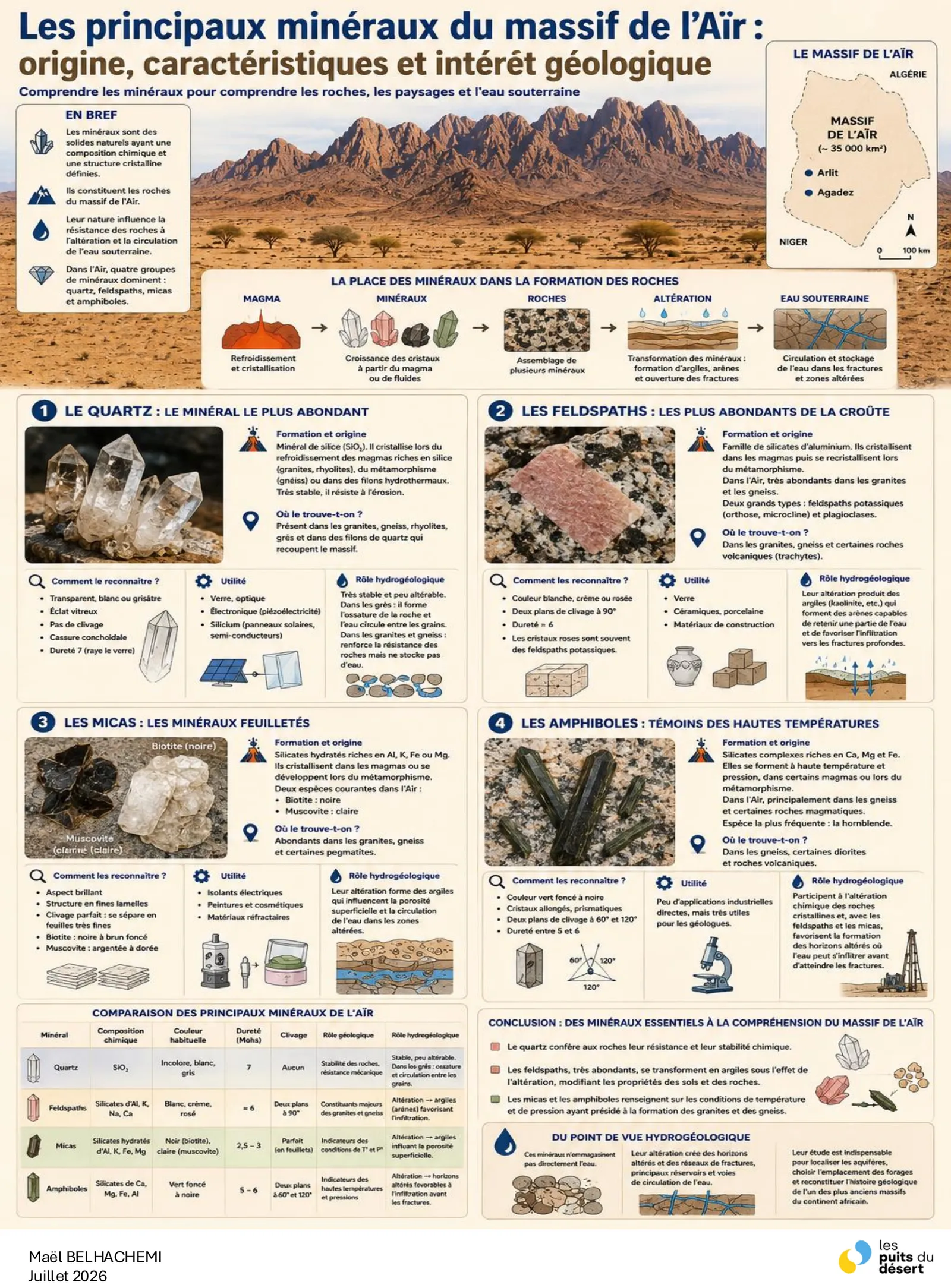
Minerals make up rocks, and their nature directly influences how those rocks resist weathering and how groundwater circulates. Four groups dominate in the Aïr. Quartz, the most abundant and chemically very stable, lets water flow between grains without loading it. Feldspars, abundant in granites and gneisses, weather into clays: they slow infiltration and alter soil properties. Micas and amphiboles record the temperature and pressure conditions under which the rocks formed. Understanding these minerals means understanding why two neighbouring boreholes do not yield the same water.
How water is located before digging
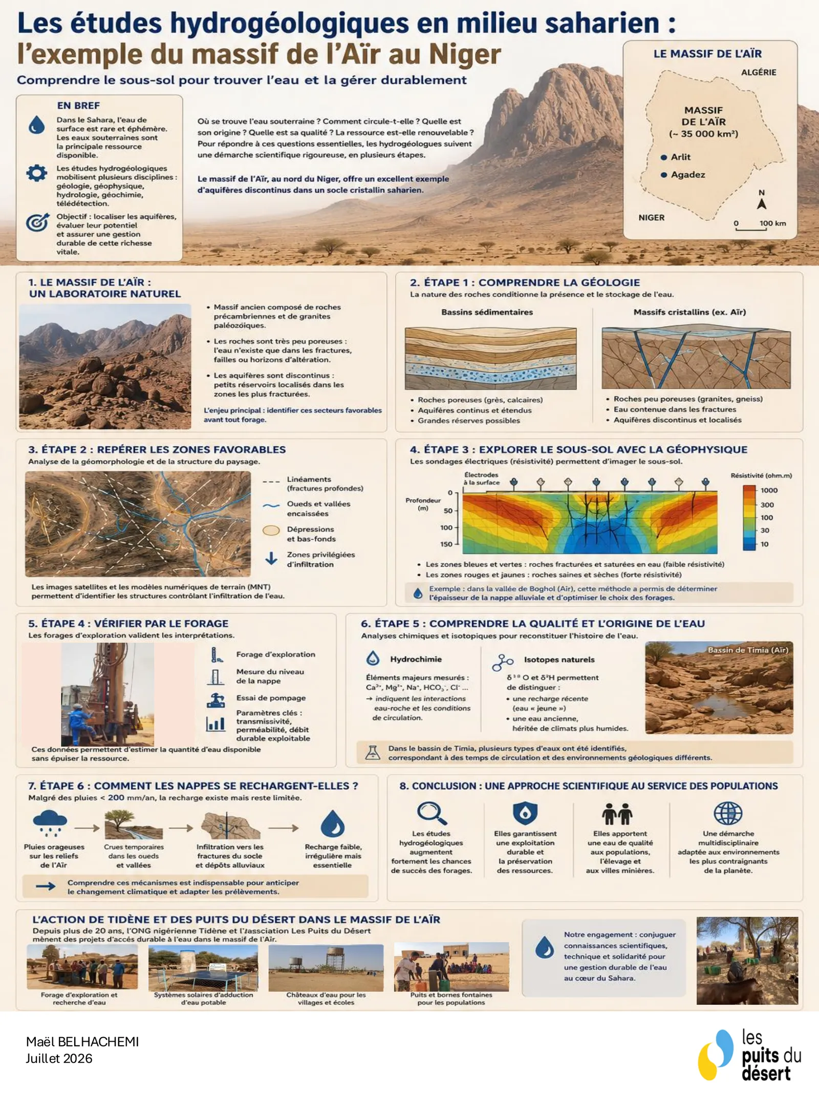
Drilling at random, in a crystalline basement where aquifers are discontinuous and localised, is a gamble. A hydrogeological study therefore follows six steps. It starts with understanding the geology, since rock type governs where water is present and stored. Favourable zones are then identified by analysing relief and lineaments, using satellite imagery and digital terrain models. Geophysics — electrical resistivity soundings — images the subsurface without digging. An exploratory borehole then verifies the interpretations and measures the water table. Hydrochemistry and isotopes finally reconstruct the quality and origin of the water, distinguishing recent recharge from ancient water. What remains is to understand how aquifers recharge at all, with less than 200 mm of rain a year.
Harvesting rainwater in the Aïr massif
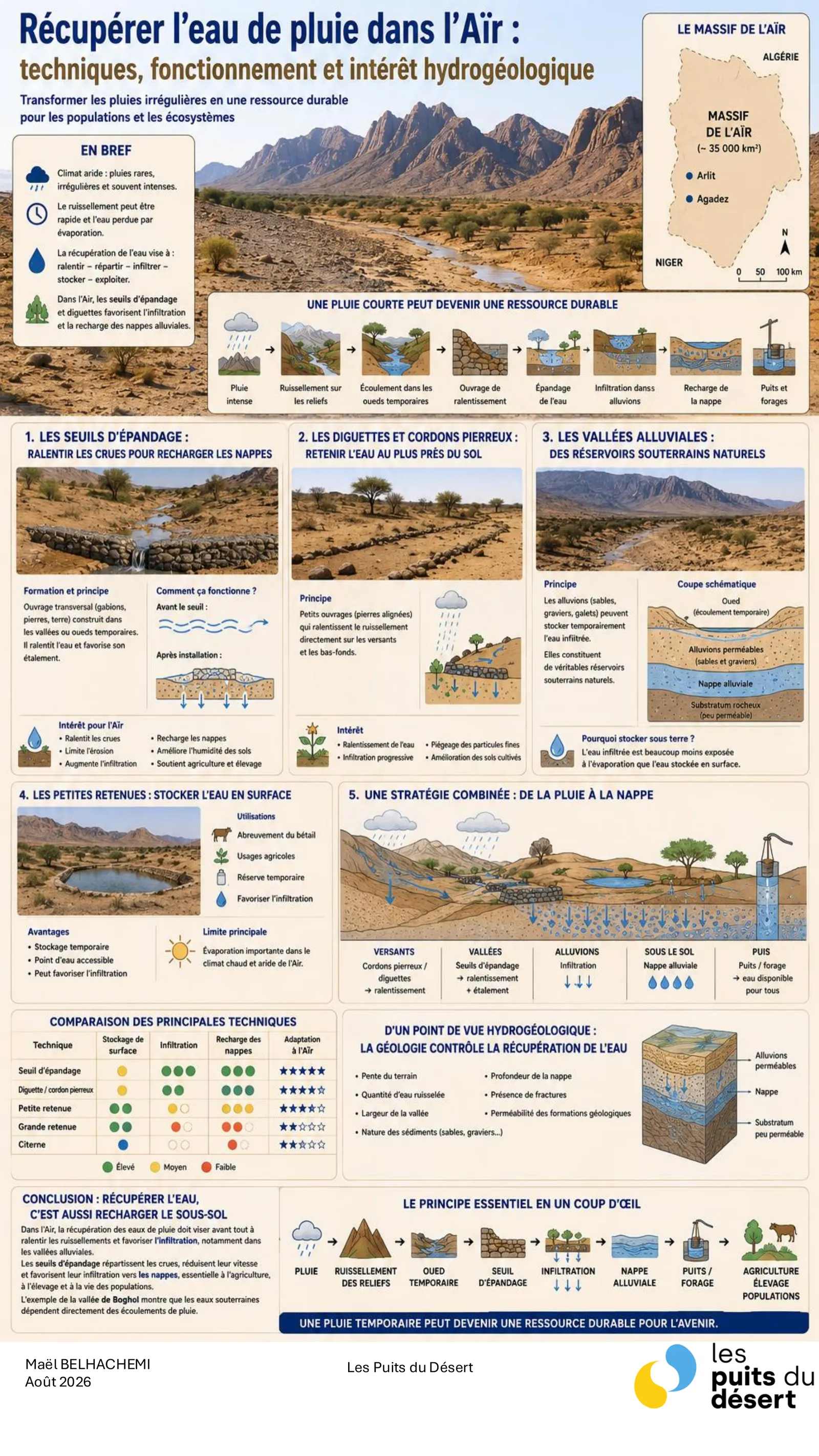
In a climate where rain is rare and violent, runoff is fast and water is lost to evaporation. Harvesting therefore aims at four actions: slow, spread, infiltrate, store. Spreading weirs, transverse structures built across temporary wadi valleys, curb floods and encourage them to spread out. Small dykes and stone lines hold water close to the soil on the slopes. Alluvial valleys act as natural underground reservoirs, where infiltrated water is far less exposed to evaporation than at the surface. Small reservoirs, finally, store water at the surface at the cost of heavy evaporation. Harvesting water is above all about recharging the ground beneath.
How a village well is built
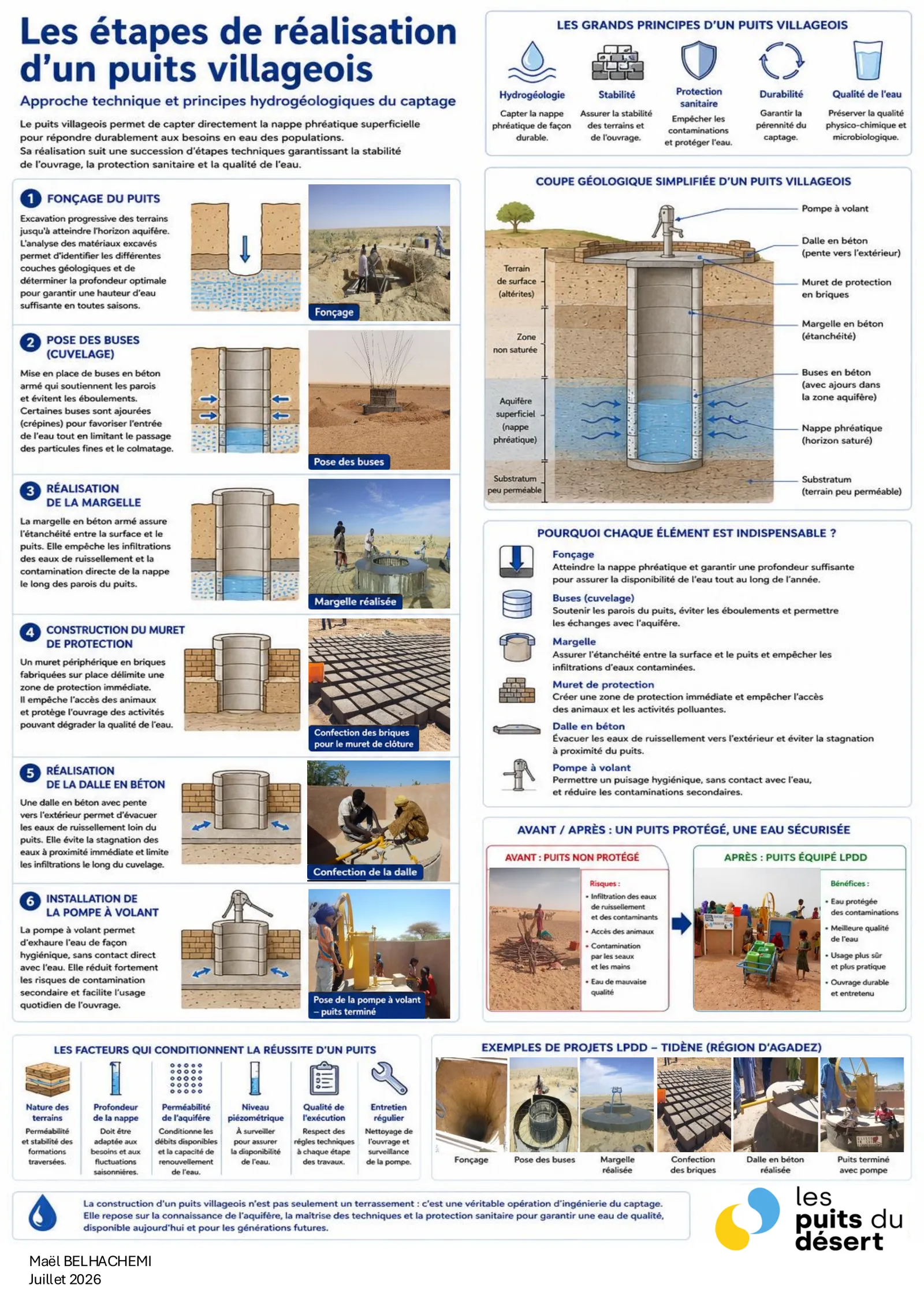
A village well taps the shallow water table directly, and building one follows six steps, each securing one aspect of the structure. Sinking, the progressive excavation down to the aquifer horizon, determines how much water is available year-round. Reinforced concrete rings support the walls and prevent collapse. The headwall seals the junction between surface and well, keeping runoff from contaminating the aquifer. The protective wall marks out a sanitary zone and keeps animals away. The concrete apron drains runoff outwards. The hand pump, finally, allows drawing water without direct contact. Between an unprotected well and an equipped one, the difference is not comfort but the sanitary quality of the water.
Solar-powered wells
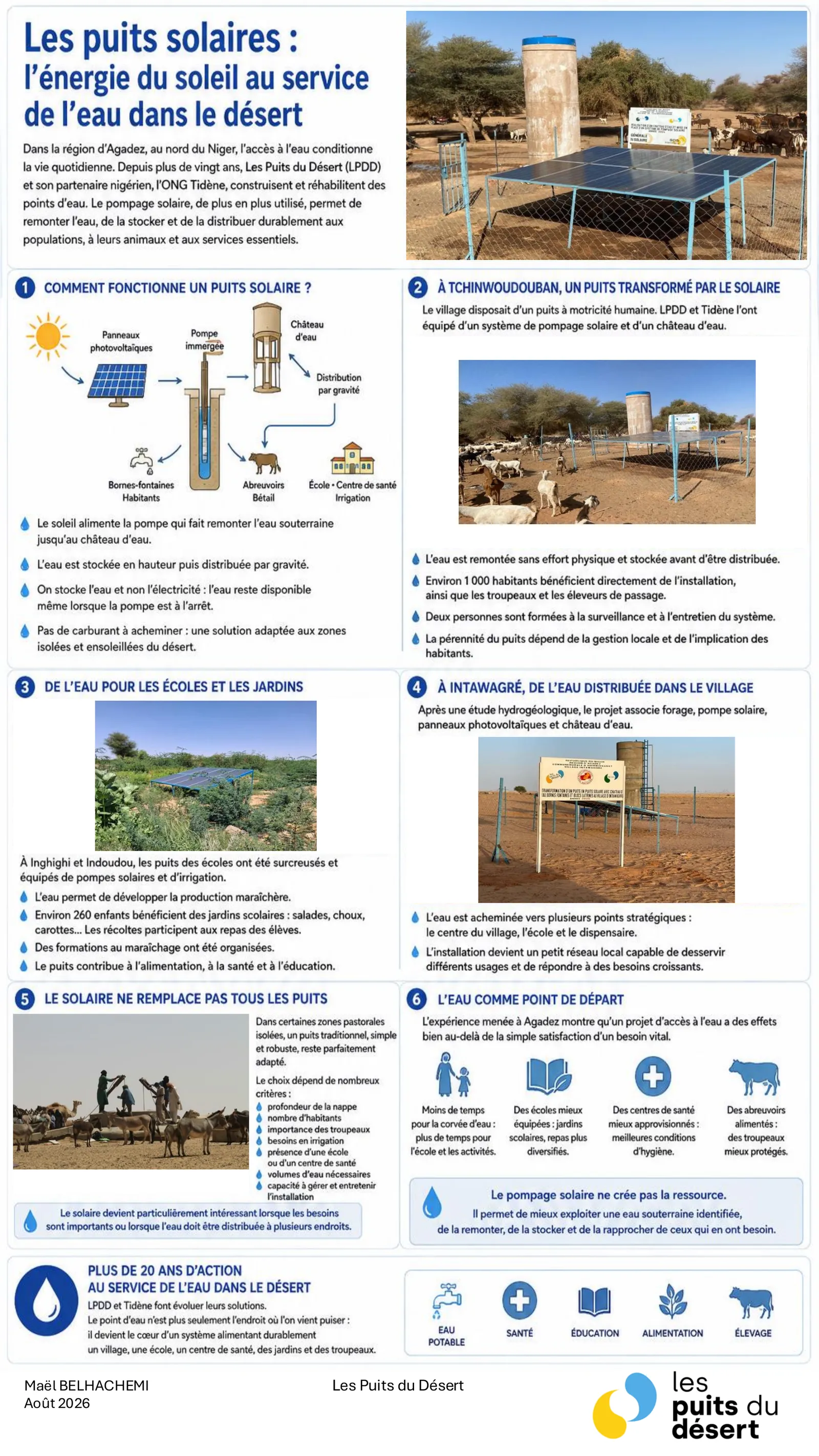
Solar pumping lifts groundwater, stores it in a raised tank and distributes it by gravity — with no fuel to transport, and available even when the pump is off. At Tchinwoudouban, a hand-operated well fitted with a solar system and a water tower serves around 1,000 inhabitants plus herds and passing herders; two people were trained to maintain it. At Inghighi and Indoudou, school wells deepened and fitted with solar pumps irrigate school gardens benefiting around 260 children. At Intawagré, water is carried to the village centre, the school and the health post. Solar does not replace every well: in isolated pastoral areas, a simple, robust traditional well remains perfectly suited.
See where the water flows today
This science comes to life in the field: explore the wells funded by Les Puits du Désert in the Agadez region on the interactive map.